Maps of Florida Home > Florida Map Collection > Map of Fort Lauderdale
Street Map of Fort Lauderdale
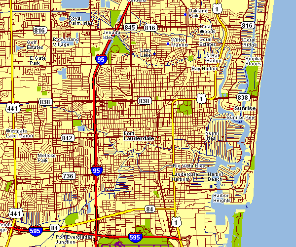
The above is a basic representation that displays the geography of this neck of the woods with a basic group of map elements.
You may print the map and make use of it in your research. Citing this page is very much appreciated.
In case you are hoping for help acquiring a map, a special kind of map, or are hoping for a good specially made preparation, quickly contact us.
Buy tip-top custom maps from us. Custom maps made by YellowMaps embrace a useful combination of map components, e.g.: highways, scale bar, coordinates, cities, lakes, towns, cliffs, or natural resources sites, etc. Types of maps reach from regional to satellite, travel to research, regional to places.
Good maps are accurate, current, and not misleading. First-Rate cartography by YellowMaps.
To acquire hardcopy maps, such as backroad mapbooks, state maps, or topographic maps, quickly explore our online map store There, you will discover more than 100,000 map products.
Maps are beautiful.
Back to Florida map collection